Last weekend we took a short break to camp at beautiful Charleston Lake, Ontario. We camp here every summer usually for an extended weekend only. Every time we camp here, though, I'm wishing we had booked a longer stay. The lake is perfect for canoeing as there are so many islands dotting the lake and so many hidden coves to explore. Wildlife abounds, and there are some marshes that hold interesting sights when you can slip through them in a canoe.
Our site was right on the water, which was great for accessing the lake. It was so nice to just leave the canoe on the water's edge rather than hike it up onto the truck every time we wanted to go for a paddle.
 |
| the short trail from trailer to lake |


For the past few years I've taken this same shot of the trees that toppled over during a storm. I like to look back and see the progression of change on this rock.


No matter where we stopped, there was a beautiful view to admire. Not all of this lake is parkland. Much of the land surrounding the lake is privately owned. The same goes for the islands. We picked up a map of the entire lake (so we wouldn't get lost when paddling!), and it marked which islands were private or park. Sometimes you just gotta stop and take a break ;)


This is one of the few boat-in campsites available. They make it easy for campers with large wooden platforms to set your tent on. Maybe that helps keep the big black rat snakes out of your tent? We saw some of these snakes and the park is very protective of their slightly famous reptiles. The snakes are harmless ... just 5 feet long!!


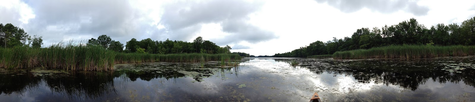
The shoreline all around the lake is very rocky. There is an interesting trail that we went along that discussed the Canadian Shield. I love rocks ... big and small.

Typical cliffs around the lake ... I get a crick in my neck when we paddle this lake :)
 |
Much of the bird sightings were in the marshes. Redwinged black birds, great blue herons, little green herons, ducks, cormorants, ospreys, loons ... and snakes too :P


 |
| an old disused boardwalk |
 |
| the new boardwalk and old boardwalk |

This beaver lodge hasn't been used in previous years, but the beavers have been busy piling up the branches this summer. As I was taking this shot we kept drifting closer and closer to the lodge. When we had bumped up alongside it, I realized there were all kinds of rat snakes sunning themselves among the branches!! I hate snakes, and couldn't back the canoe up fast enough.

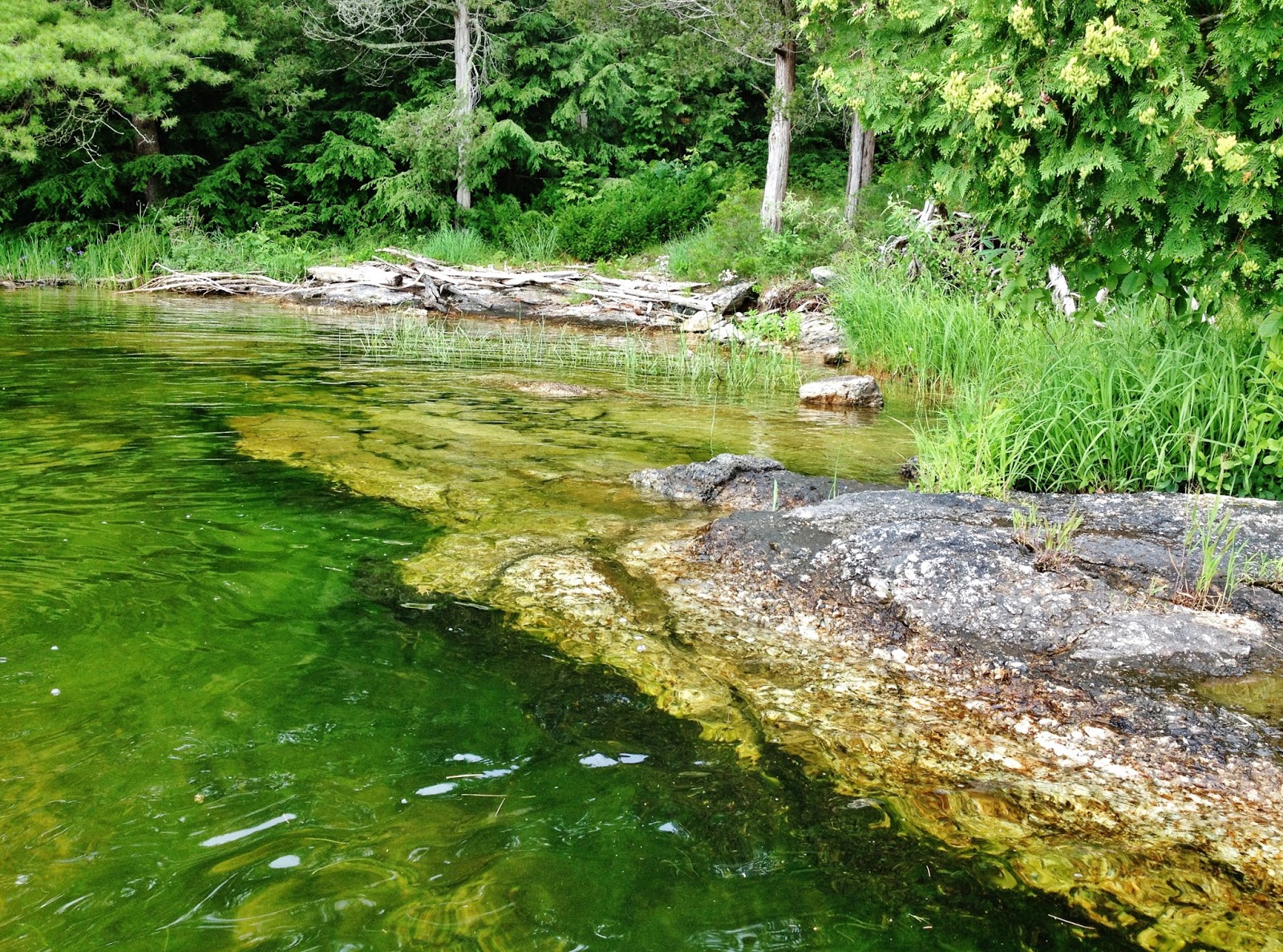
More shoreline shots ...


These next shots are along the Sandstone Trail. Lots of interesting rock formations here, and in particular a huge rock overhang where people have taken shelter. Archaeologists have found bones and pottery dating back 1200 years. So although Canada is just a young country, people have been living here thousands of years ago. Another panoramic shot ... the overhang doesn't look high in this photo, but the clearance underneath is between 8 - 10 feet.

For those of you wondering about these rock formations, this is from the trail guide:
"Paleozoic seas began to cross the ancient continent of North America 480 million years ago. As these extensive seas developed, their advancing coastal waters reworked the rock and primitive soils of the Precambrian Shield, mixing stones and small boulders together with sand. Over millions of years these beach deposits hardened into stone. Now they form the walls and roof of the rock shelter ahead of you. The walls are composed entirely of small rounded boulders, cobbles, pebbles and sand. Geologists call this type of rock formation 'conglomerate' ..."
You can see the conglomerate rock below ... you can also see my husband patiently waiting for me to finish taking photos and giving a nice comparison to the height of the overhang.


This curved stone cliff was once a waterfall (below) ...

Another interesting feature in the rocks are these scrape marks ("striations") caused by large bolders and rocks trapped in a glacier and pushed across the sandstone as the glacier moved along.


This whole trail goes around "Sandstone Island", the name given to this portion of land which was once a poor farm. All this land was cleared by hand, and the farmer and his family tried hard to make a living here. The soil wasn't very good for crops, however, and he resorted to selling maple syrup, raising cattle, selling berries and basically, just scraped by here. His son became a stone mason, and some of his work remains deep in the forest that has grown up covering up most evidence of their harsh life here.

 |
| all this forest was cleared by the farmers |
 |
| the farmers' old sugar maples are still standing |

 |
| a beautiful oak |

Below are two stone pillars that the farmer's son built marking the entrance to their farm. You can make out the pile of stones on each side of the path. I remember them being in much better shape a few years ago, but I don't know if weather or people have caused them to crumble.

Maybe people have stolen the rocks to build their own creations ...
Well, this post is (I'm sure) trying your patience with all my chattering and overload of photos. We had a wonderful time, despite the poison ivy bordering the trail to the lake ;) Honestly, I'm not even going to proofread this post ... I'm just going to add a few more photos at the end here and call it a day.

 |
| poison ivy |
This was our view at the waterfront ... watching the sun set as the storm clouds brewed ...


The bugs were terrible, and we came home with many bites despite the use of bug spray. The mosquitoes got us on land, and the deer flies got us on the water.
 |
| blue lakes and rocky shores ... |
 |
| a great blue heron up in the pines |
A pretty cove where we just drifted admiring the fish and turtles that swam underneath our canoe.


Here's one for the Furry Gnome ... this barn is just outside the campground and it's sporting some huge quilt squares! Furry had gone on a tour of barns with quilt squares last summer.

That's it folks! My husband and I were busy all day long during our stay, but by late afternoon it was time to stop amongst the poison ivy and Make Time for Tea ... and a Canadian butter tart! This one had pecans. The melmac plate and mug were my parents' and were taken on many camping trips during my childhood. These things never wear out!

Cheers!